When we bought our house on the Back River in east Friendship, Maine Jeff Armstrong said "you've got a million dollar view and your neighbors are paying the taxes." Beautiful and protected by shore land zoning, it is where we walk, row, and where we scattered ashes of my sister Kathryn. We asked Kat Logan, a talented local painter, to capture in oil the view from our living room seen in the attached photo. We call it Heron Bend.
Sunday, April 10, 2016
Saturday, April 9, 2016
The Secrets of the Wave Pilots - The New York Times

The Secrets of the Wave Pilots - The New York Times
by Kim Tingley //March 16, 2016
At 0400, three miles above the Pacific seafloor, the searchlight of a power boat swept through a warm June night last year, looking for a second boat, a sailing canoe. The captain of the canoe, Alson Kelen, potentially the world’s last-ever apprentice in the ancient art of wave-piloting, was trying to reach Aur, an atoll in the Marshall Islands, without the aid of a GPS device or any other way-finding instrument. If successful, he would prove that one of the most sophisticated navigational techniques ever developed still existed and, he hoped, inspire efforts to save it from extinction. Monitoring his progress from the power boat were an unlikely trio of Western scientists — an anthropologist, a physicist and an oceanographer — who were hoping his journey might help them explain how wave pilots, in defiance of the dizzying complexities of fluid dynamics, detect direction and proximity to land. More broadly, they wondered if watching him sail, in the context of growing concerns about the neurological effects of navigation-by-smartphone, would yield hints about how our orienteering skills influence our sense of place, our sense of home, even our sense of self.
When the boats set out in the afternoon from Majuro, the capital of the Marshall Islands, Kelen’s plan was to sail through the night and approach Aur at daybreak, to avoid crashing into its reef in the dark. But around sundown, the wind picked up and the waves grew higher and rounder, sorely testing both the scientists’ powers of observation and the structural integrity of the canoe. Through the salt-streaked windshield of the power boat, the anthropologist, Joseph Genz, took mental field notes — the spotlighted whitecaps, the position of Polaris, his grip on the cabin handrail — while he waited for Kelen to radio in his location or, rather, what he thought his location was.
The Marshalls provide a crucible for navigation: 70 square miles of land, total, comprising five islands and 29 atolls, rings of coral islets that grew up around the rims of underwater volcanoes millions of years ago and now encircle gentle lagoons. These green dots and doughnuts make up two parallel north-south chains, separated from their nearest neighbors by a hundred miles on average. Swells generated by distant storms near Alaska, Antarctica, California and Indonesia travel thousands of miles to these low-lying spits of sand. When they hit, part of their energy is reflected back out to sea in arcs, like sound waves emanating from a speaker; another part curls around the atoll or island and creates a confused chop in its lee. Wave-piloting is the art of reading — by feel and by sight — these and other patterns. Detecting the minute differences in what, to an untutored eye, looks no more meaningful than a washing-machine cycle allows a ri-meto, a person of the sea in Marshallese, to determine where the nearest solid ground is — and how far off it lies — long before it is visible.
Sunday, April 3, 2016
A Workhorse on the Hudson River, Now Retired From Fighting Fires, Chugs Toward a Second Act - The New York Times

A Workhorse on the Hudson River, Now Retired From Fighting Fires, Chugs Toward a Second Act - The New York Times
BY Noah Remnick
ABOARD THE JOHN D. McKEAN, in Tarrytown, N.Y. — On a gleaming Thursday morning in March, a candy red fireboat rattled awake and set forth from its station in the Brooklyn Navy Yard. As the ship voyaged north along the Hudson River at nine knots, it left more than half a century of history in its wake.
Since the 129-foot vessel, the John D. McKean, was commissioned into service in 1954, the sight of it on New York City’s waterfront has signaled some variety of peril — a smoldering warehouse, a capsized barge.
It was there to douse the flames when a fire in 1991 swallowed the Manhattan terminal of the Staten Island Ferry. It shuttled hundreds of people to safety in Jersey City after the World Trade Center was attacked on Sept. 11, 2001, and supplied firefighters with water at ground zero for days thereafter. It gave refuge to passengers huddled on the water-lapped wings of US Airways Flight 1549 after it landed in the Hudson River in January 2009.
Even the ship’s name bears the weight of the New York Fire Department’s past: John D. McKean, a marine engineer, was burned to death in 1953 when he stayed at his post on the fireboat George B. McClellan, trying to steady the vessel after a steam explosion. Mr. McKean’s son and grandson both followed him into the department.

Saturday, April 2, 2016
Winds and Coastlines | Issuma in Antarctica
Winds and Coastlines | Issuma
Nautical chart Maxwell Bay, South Shetland Islands, Antarctica
annotated for wind data by Richard Hudson
Winds and Coastlines | Issuma
Richard, George and Sarah are the crew aboard Issuma. Richard, with his usual matter of fact style, here recounts a rough spot while anchored in one of the most protected bays around. BTW the centerboard is not like the one on your dinghy. It carries several hundred liters of diesel fuel - and swings up the better to minimize damage from hitting ice. Issuma was built for these waters. - gwc

annotated for wind data by Richard Hudson
Winds and Coastlines | Issuma
Richard, George and Sarah are the crew aboard Issuma. Richard, with his usual matter of fact style, here recounts a rough spot while anchored in one of the most protected bays around. BTW the centerboard is not like the one on your dinghy. It carries several hundred liters of diesel fuel - and swings up the better to minimize damage from hitting ice. Issuma was built for these waters. - gwc
Weather forecasts can be tricky sometimes. We were anchored peacefully where the black arrow is on the picture, with a moderate (20-25 knot) SSW wind forecast for the general area (I get these forecasts from Gridded Binary (GRIB) data from a US National Weather Service computer via email). I figured we would be well protected by the long island south of us (Ardley Island).(if you read the Norwegian Maxwell Bay forecast above remember that is Beaufort Scale, so a `strong breeze' is 21-27 kts gusting to 31 kts with wave height 91/2 to 13 feet.)
What I didn't think about was the possible effect on the wind that the shape of the bay we were in could have. As the wind steadily built, it moved to the ESE, from which we had no protection. While the anchor was holding, it might drag if the wind increased a lot (one always needs to think about what might happen if the wind is stronger than expected), and floating ice would then be blown towards where we were anchored. It was time to leave.
We raised anchor and motored out into a 25 knot headwind and choppy seas. Still surprised by the wind direction and increasing strength, I called up the nearby Chilean base on the VHF radio and asked if they had a forecast for Maxwell Bay.
They said yes, the wind forecast was for ESE to SE 40 knots. That would be a major problem to have stayed anchored where we were. It took several hours of motoring into the wind and seas to reach a bay on the eastern side, where we found a place to anchor near a glacier. At one point, we hit either a growler or an uncharted rock with the centerboard--the centerboard pivoted up and then broke the centerboard cable when it fell back down after passing over the obstruction. We replaced the centerboard cable later at anchor (this is not a big job, but it involves climbing into the narrow centerboard case to thread the new cable, which Sarah--who is thinner than I am--did).
Looking at the chart later, I began to understand why the SSW wind that I expected was actually a SE wind inside Maxwell Bay. The way I've drawn the arrows on the chart picture, it looks obvious, but it wasn't until I looked closely at the chart, and considered the height of the mountains (which deflected the wind, instead of letting it pass over), that I concluded the outside wind probably was a SSW and that it was deflected by the shape of the bay.
The Chilean forecast is probably available to vessels with Inmarsat C, but is not on NAVTEX (which Issuma can receive). I could receive the Chilean Antarctic forecasts via email from the internet, but only after a delay of 24 or more hours (for a 24-hour forecast). Later, I learned of a great Norwegian website (www.yr.no) that collects weather forecasts from various sources and makes them available (in a way that can be retrieved via email). I was then able to get China's forecasts for Maxwell Bay via email.
Thursday, March 31, 2016
For the Love of a Boat - High Idle - Jeff Armstrong
| Jeff & Nancy leaving Thomaston for Hupper Island |
My dear friend Jeff Armstrong, who passed away on January 11 lived every day to the fullest. On the day before he went to Portland for the last, heroic efforts to extend his life, I stood with him in his basement workshop as he carved another black walnut wooden spoon and instructed Kathryn's beau Max Holm on how to turn bowls on the lathe.
One of his passions was his 1963 Thompson 21' - High Idle, which carried him and many friends and family for forty years to destinations on the St. George River and Muscongus Bay - from Thomaston to Monhegan. That last destination is memorialized by James Wyeth - who painted it in gratitude for a mission of mercy Jeff once did for Jamie's wife.
| Jeff |
What do we mean when we say For the Love of A Boat? Many of us share a passion for wooden boats - but few have put more into theirs than Jeff did for High Idle. Click on that link above for a special piece of writing by Jeff - completed three years to the day before his death - and published only now by his family and friends at Jeff's Marine.
| The Pirate of the Mid-coast. Why he thought that was a selling point none will ever know. |
Monday, March 28, 2016
Issuma reaches Antarctica
Richard Hudson has achieved his dream: After a peaceful journey across the 400 mile Drake Passage he and his crew aboard Issuma arrived at the protected harbor of Deception Island, South Shetland Islands, Antarctica. They've been at Maxwell Bay for a while - at Jaroslav Pavlicek's Eco-Nelson base. Nice spot. Check it out here at ISSUMA. - George


Friday, March 25, 2016
Lost Navy tug USS Conestoga found

The men of the lost USS Conestoga.
NOAA researchers have found the Navy tug USS Conestoga. In 1921 it was lost on its way to Samoa, was sank just twenty miles of so outside San Francisco, near the Farallon islands where it probably sought refuge, The New York Times reports
Wednesday, March 23, 2016
Sunday, March 13, 2016
Rainbow - 360 degrees - The Weather Channel
I remember a spring day like this - one rainbow after another as Taisy and I drove from Clare through the lakes of Killarney to Kinsale. Unfortunately Taisy lost the film. This sort of makes up for it. - gwc
https://www.facebook.com/TheWeatherChannel/videos/10154092334385921/
A magnificent full-circle rainbow was filmed by a drone in Cookstown, Ireland. If you look closely, you can see that part of it makes up a double rainbow!
Posted by The Weather Channel on Tuesday, March 8, 2016
Friday, February 26, 2016
Lumber Yard Skiff Scrapbook — Old Wharf Dory
Skiff Scrapbook — Old Wharf Dory
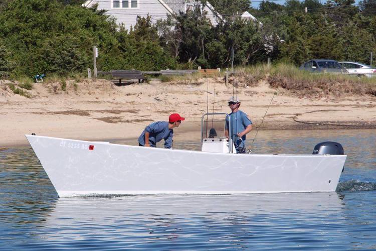
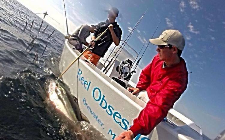
A Lumberyard Skiff - of the type we built five years ago at Wooden Boat
School with the creator Walter Baron.


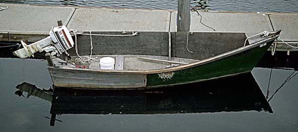
The first Lumberyard Skiff - 1993, seen here in 2015

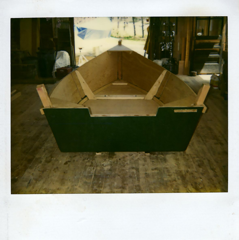
A newbie

A Lumberyard Skiff - of the type we built five years ago at Wooden Boat
School with the creator Walter Baron.


The first Lumberyard Skiff - 1993, seen here in 2015

A newbie

Subscribe to:
Posts (Atom)